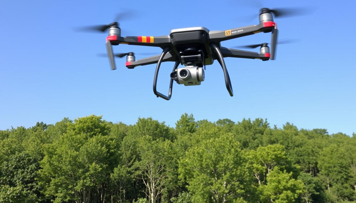
Have you ever thought about how drones are changing scientific research? They’re used for aerial data collection, environmental monitoring, and more. Drones are making research exciting and opening new doors for scientists.
Since 2010, drones have become key in research. They’re better, cheaper, and last longer. They let scientists reach places they couldn’t before, study wildlife without disturbing it, and take detailed pictures for maps and 3D models. Drones help track endangered species and study volcanoes, showing their value in research.
Drones offer a unique view of the world. They use cameras, thermal imaging, and sensors to collect data. This data helps scientists understand our world better, from the ocean to the sky.
Drones are more than a trend in science. They’re starting a new era of discovery. They push the limits of what’s possible. Let’s explore how drones are changing science together.
Key Takeaways
- Drones have revolutionized scientific research by providing a versatile and efficient tool for data collection and analysis.
- Aerial data collection, environmental monitoring, archaeological surveys, and precision agriculture are some of the key areas where drones are making a significant impact.
- Drones enable scientists to access hard-to-reach areas, monitor wildlife non-invasively, and gather high-resolution imagery for mapping and 3D modeling.
- Advancements in electronic technology, reduced costs, and improved battery power have made drones more accessible and practical for research purposes.
- Drones equipped with digital cameras, thermal imaging, and hyperspectral sensors can capture unique data that would be difficult or impossible to obtain through traditional methods.
Drones: A Game-Changer for Scientific Research
Drones, also known as unmanned aerial vehicles (UAVs), have changed how scientists do research. They’ve come a long way since the 1900s. Now, they’re more affordable and efficient thanks to better technology and materials.

Drones can go where humans can’t, like remote jungles or vast oceans. They can also survey dangerous mountain ranges. This makes them key tools in many scientific fields.
Evolution of Drone Technology
Drone tech has improved a lot. This is thanks to advances in several areas:
- Electronic technology: New, smaller parts have made drones more compact and efficient.
- Cameras and sensors: Better cameras and sensors let drones capture detailed images and data.
- Battery power: New batteries have made drones fly longer and carry more, boosting their range and use.
- Materials science: Using light materials like carbon fiber has made drones lighter and more agile.
Advantages of Drones Over Traditional Research Methods
Drones have many benefits over old ways of doing research:
- Accessibility: Drones can get to places humans can’t, opening up new areas for study.
- Non-invasive data collection: Drones can collect data without harming the environment or wildlife.
- High-resolution imagery: With advanced cameras, drones can take detailed pictures and make 3D maps.
- Cost-effectiveness: Drones are often cheaper than using manned aircraft or ground surveys.
Being able to see the drone’s operator helps in research. This lets researchers control the drone well and adjust to changes quickly. It ensures the data they collect is good and useful.
Versatility of Drones in Various Scientific Fields
Drones have changed how scientists do research. They help in many areas, from finding old ruins to protecting nature. Let’s see how drones are making science better.
Archaeological and Ethnographic Research
Drones with cameras and LiDAR technology are key for archaeologists and ethnographers. They take clear pictures from above and make 3D maps of old sites. This helps find hidden spots, study how things are arranged, and watch excavations grow.
This way of working doesn’t harm the artifacts. It makes it easier to record and protect cultural sites.
Environmental Monitoring and Conservation

In environmental science, drones are very important. They help track animals, study plants, and check how healthy ecosystems are. Drones can quickly cover big areas and reach places that are hard to get to.
This data is key for saving nature and fighting climate change.
Here are some facts about drones in environmental research:
- UAVs can go into disaster zones, move fast, and do missions from the air. They’re very useful.
- Most studies use multirotors because they’re easy to control and precise.
- UAVs make surveying, inspecting, and sampling much faster and easier.
Meteorological Research and Climate Observation
Drones with special sensors are great for weather and climate studies. They collect data on temperature, humidity, wind, and air composition at different heights. This helps scientists understand weather, track climate change, and make better forecasts.
Drones can also study extreme weather like hurricanes and tornadoes. They provide important data for disaster response and risk planning.
“Drones have opened up new possibilities for scientific research, allowing us to gather data in ways that were previously impossible or prohibitively expensive.” – Dr. Sarah Johnson, Environmental Scientist
The table below shows how drones are used in different scientific fields:
| Scientific Field | Key Applications |
|---|---|
| Archaeology | Site mapping, artifact documentation, excavation monitoring |
| Environmental Science | Biodiversity monitoring, plant species identification, habitat mapping |
| Meteorology | Weather data collection, climate observation, extreme weather monitoring |
| Geoscience | Coastal region mapping, glacier surveillance, volcanic activity monitoring |
As drones get better, we’ll see more new uses in science. They’re great at getting good data quickly and safely. Drones are becoming very important for learning about our world.
Enhancing Data Collection and Analysis with Drones
Drones have changed how scientists collect and analyze data. They offer high accuracy and efficiency. With different payloads, drones can capture detailed images, create 3D maps, and measure things precisely.
Drones with digital cameras take amazing aerial photos and videos. These images help researchers see their study areas from above. They can make detailed 3D models and maps for deeper analysis.
Thermal and Hyperspectral Imaging
Thermal cameras on drones are very useful. They spot heat, helping researchers find wildlife, check plant health, and find industrial hazards. Hyperspectral imaging captures data across many electromagnetic spectra. It lets scientists see plants and water features not visible to the eye.
LiDAR Technology for Precise Measurements
LiDAR technology is popular in drone research. It uses laser pulses to measure distances and create accurate 3D models. LiDAR drones can make detailed digital elevation models, measure tree and building heights, and spot landform changes.
| Drone Payload | Applications |
|---|---|
| Digital Cameras | High-resolution imagery, 3D mapping |
| Thermal Cameras | Wildlife monitoring, vegetation health assessment |
| Hyperspectral Imaging | Plant and water feature identification |
| LiDAR | Precise distance and height measurements, 3D modeling |
Drone technology is advancing fast. This lets researchers collect and analyze data more accurately and efficiently. As the drone market grows, we’ll see more drones in science, changing how we study our world.
Benefits of Using Drones in Research
Drones are changing the game in scientific research. They offer many benefits that make data collection and analysis easier. These unmanned aerial vehicles allow for low-invasive investigation. This means researchers can reach areas that were hard to get to before, without harming the environment.
Using drones is also cost-effective. Traditional methods like manned aircraft or satellites can be very expensive. Drones provide a cheaper way to get high-quality data, making research more affordable for everyone.
Drones can be used in many different places. They can fly over vast areas quickly. For example, the Drone AQUILA X2 in Meghalaya, India, flew 25 km in under 25 minutes. This makes drones great for quick research projects or emergencies.
Drones also have special features that help research. They can take detailed pictures, make 3D maps, and collect special data. These abilities help researchers get more accurate and detailed information. Drones in construction and infrastructure projects show their value in many areas of research.
| Benefit | Description |
|---|---|
| Low-invasive investigation | Drones allow researchers to collect data without disturbing delicate environments or subjects |
| Efficient data collection | Drones can cover vast distances quickly, enabling rapid data collection |
| Cost-effective | Drones provide a low-cost alternative to traditional research methods, such as manned aircraft or satellite imagery |
| Versatility | Drones can be deployed in a wide range of settings, from remote areas to urban environments |
| Advanced capabilities | Drones can capture high-resolution imagery, create 3D maps, and collect thermal and hyperspectral data |
The use of drones in research has opened up new possibilities, allowing us to explore previously inaccessible areas and gather data in ways that were once unimaginable.
As drone technology gets better, its benefits in research will grow. With better batteries, more carrying capacity, and better sensors, drones will be even more useful. By using drones, we can discover new things, make important discoveries, and expand our scientific knowledge.
Drones in Wildlife Conservation and Animal Population Studies
Drones have changed how we study wildlife and track animal populations. These flying machines help us watch endangered species and sea mammals without disturbing them. They send back clear images and data, making them key in protecting our planet’s ecosystems.
In 2022, the market for wildlife drones hit $3.70 billion and is growing fast. Drones are better than old ways of studying animals because they’re quick and save money. They also keep researchers safe by letting them watch from afar.
Non-Invasive Monitoring of Endangered Species
Drones are great for watching endangered animals without scaring them. Old methods could stress animals and change their behavior. But drones can watch from far away, helping us learn about animals without bothering them.
There are many types of drones for different jobs:
- Fixed-wing drones are best for big areas because they’re fast.
- Multirotor drones are good for close-up looks, even in tight spots.
- Hybrid VTOL drones are great for tough places because they can take off and land vertically.
Tracking Sea Mammals and Marine Conservation
Drones are also helping in the sea, tracking sea mammals and checking on coastal areas. They have special cameras and sensors to collect important data. This data helps us make better plans to protect the ocean and its creatures.
“The integration of Artificial Intelligence with drones is expected to improve decision-making processes in wildlife conservation efforts.”
As drones get better, so will our chances to save wildlife. We need to keep investing in drone tech and how to use the data. This will help us protect our planet’s animals for a long time.
| Drone Type | Flight Time | Range | Payload Capacity |
|---|---|---|---|
| Fixed-wing | Up to 90 minutes | Up to 10 km | Up to 2 kg |
| Multirotor | Up to 30 minutes | Up to 5 km | Up to 5 kg |
| Hybrid VTOL | Up to 60 minutes | Up to 15 km | Up to 3 kg |
Drones for Disaster Response and Risk Assessment
Drones are changing disaster response and risk assessment. They help monitor natural disasters and assess damage. DJI says drones saved 279 lives before COVID-19. Their quick deployment and advanced sensors are making a big difference.
Between 2002 and 2012, global disasters killed 1.2 million people and caused $1.7 trillion in damage. The 2015 Nepal earthquake showed drones’ value. They can reach areas fast, even when roads are destroyed.
Monitoring Natural Disasters and Their Aftermath
The DJI Matrice 300 RTK can fly for up to 55 minutes. It’s great for surveying disaster areas. The Parrot Anafi USA has a 32x zoom camera and FLIR thermal sensor, helping in search and rescue.
The SenseFly eBee X is perfect for damage assessments. It can fly long distances and map areas in high detail. Drones have been used in many disasters, like in Haiti and after Hurricane Katrina.
Assessing Risks in Hazardous Environments
Drones are great for assessing hazardous environments. They can cover more ground than traditional methods. They help find victims fast and do remote triage, improving care.
Drones can send vital signs like body temperature and heart rate. They don’t need special setups, making them easy to use in emergencies. Algorithms help sort injured people by priority, making rescue efforts more effective.
Drones are key in disaster response and risk assessment. Their advanced features and algorithms are changing how we handle crises. They help save lives and reduce damage.
Precision Agriculture: Drones Revolutionizing Farming Practices
In recent years, precision agriculture has changed farming. Drones are key in this change. They help farmers watch over their crops better, improve yields, and make smart decisions for a greener, more profitable farm.
Drones help farmers check on their crops quickly and accurately. They are 90% faster than old methods. Drones have special sensors and cameras that take detailed pictures and data. This lets farmers spot problems early and fix them fast.
Using drones for spraying is also a big plus. It cuts down chemical use by 30-40%, which is good for the environment and saves money. Drones can also check soil health better, helping farmers make better choices and manage their land better.
| Benefit | Impact |
|---|---|
| Faster crop monitoring | Up to 90% faster than traditional methods |
| Reduced chemical usage | 30-40% reduction with precision spraying |
| Improved soil health assessment | 50% increase in accuracy |
| Water savings in irrigation | Up to 25% water savings |
| Efficient livestock tracking | 70% reduction in time spent on herd monitoring |
The drone services market is growing fast, reaching USD 57.8 billion by 2028. This growth is because more farmers are using drones. They see how drones can save money, improve yields, and help the environment.
The integration of AI and machine learning with drone technology is opening up new possibilities for automated crop health assessment and real-time pest detection, further enhancing the capabilities of precision agriculture.
With water scarcity becoming a big issue, precision agriculture is key. Drones and other new tech will help farmers keep food coming and farming sustainable for the future.
Drones in Geosciences: Exploring Earth’s Mysteries
Drones have changed the game in geosciences, giving us new ways to study our planet. They let researchers explore hard-to-reach places, helping us learn more about Earth. Drones help us study volcanoes, glaciers, and coastal erosion in ways we never could before.
Studying Volcanic Eruptions and Lava Flows
Volcanoes are fascinating but dangerous to study up close. Drones have made it safer. They use sensors and cameras to get close to volcanoes, taking detailed pictures and collecting data.
For example, a project in Papua New Guinea used drones to study the Manam volcano. They flew up to 2 km high and 6 km far to collect samples. This helps us understand how volcanoes affect our climate.
Monitoring Glaciers and Ice Sheets
Glaciers and ice sheets show us how climate change is affecting our planet. Drones with LiDAR and cameras are changing how we monitor them. They create detailed 3D models and measure ice thickness.
This helps us see how climate change is impacting these areas. With over 500 volcanoes worldwide, drones are key for studying them.
Mapping Coastal Regions and Erosion
Coastal areas are always changing due to waves, tides, and storms. Drones help map and monitor these changes. They give us detailed views of erosion and how humans affect the coast.
By using aerial images and photogrammetry, researchers can make 3D models of coastlines. This lets them track changes and plan better management strategies. Drones with special sensors can also study vegetation and land use in coastal areas.
Drone technology is growing fast, and so are its uses in geosciences. They help us understand volcanoes, glaciers, and coastlines like never before. Drones give us new insights, making it easier to manage our planet sustainably.
The Future of Drones in Scientific Research
Drones are getting better and better, and their role in science is looking bright. They will soon be able to collect and analyze data more efficiently. Thanks to new tech, drones will be able to work together and tackle more complex tasks.
Already, drones have made a big difference in science. They’ve cut costs by up to 70% and improved accuracy by 20-30% in some areas. The drone market is growing fast, with a big focus on science and the environment. This means drones will play a key role in many fields, from farming to saving wildlife.
Drones might even help us explore other planets and deploy satellites. Schools like Capitol Technology University are teaching the next generation about drones. With new tech like AI and advanced sensors, drones are set to change how we study our world and beyond.